Geographic borders of Europe. About the border between Europe and Asia. Countries lying in both Europe and Asia
Travel from pillar to pillar (Bilimbay - the birthplace of the rocket plane, the holy springs in Taraskovo, Dedova Gora and Lake Tavatui).
Despite the fact that the external state borders do not pass through Yekaterinburg, we all have the opportunity to scurry from one part of the world to another several times a day. Probably, this “chronically borderline” state influences the Ural mentality in a special way. The border between Europe and Asia is our Greenwich (which is the starting point), this is our equator (cutting off the bad half) and the eternal source of motion. After all, I constantly want to know: what is there, on the other hand? Better life- or a new adventure?
Geographical encyclopedic Dictionary gives several options for drawing the border: along the eastern foothills or along the ridges of the Urals. However, these concepts are not strict enough. The most correct from a scientific point of view is the approach formulated by Tatishchev. He proposed to draw the border of the two parts of the world along the watershed of the Ural Mountains. In this case, the dividing line is complex and can be displaced.
Now installed in the Urals more than 20 obelisks Europe-Asia... The first (No. 1) is a remake (2004) on 17 km of the Moscow tract, which everyone knows, we drove without stopping. There is a lot of controversy about the correctness of the installation of this sign. He has to receive the maximum number of official delegations - of course, the place is convenient for events. Interestingly, the pedestal contains stones with extreme points Europe (Cape Roca) and Asia (Cape Dezhnev).
At the entrance to Pervouralsk from the Moscow highway (on the right, not reaching 300 meters to the stele with the name of the city) - the next sign (№2).

Initially, this monument was located near Mount Berezovaya on the old Moscow (Siberian) tract, about 300 m northeast of the present place, but was moved. Next to the sign there is a fontanelle and a sign “start of the route”.

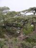
It is very likely that this path leads through the forest to the next sign (No. 3) - the most majestic one, installed at Mount Berezovaya in 2008 instead of this four-sided pyramid. It is notable for the fact that it is considered the first (earliest) "border" mark of the division of Europe with Asia, established in the Urals. We go to him by car: we reach Pervouralsk and go back about 1 km along the old Moscow highway.
Most likely this happened in 1837, as indicated on the cast-iron plate at the foot of the monument. Here, at the highest point of the Siberian tract, the exiled to Siberia stopped, said goodbye to Russia and took with them a handful of their native land.

First, a wooden monument was erected in the form of a sharp four-sided pyramid with the inscriptions "Europe" and "Asia". Then (in 1846) it was replaced by a marble pyramid with the royal coat of arms. After the revolution, it was destroyed, and in 1926 a new one was erected from granite - the one that has now been transferred to the new Moscow highway, at the entrance to Pervouralsk. In 2008, a new stele was built on this site.
Two kilometers from this pillar, on the northern slope of Mount Berezovaya, at the Vershina railway station (stopping point), there is one more (No. 4), the most authentic obelisk. Highway there is almost no access to it - but in summer you can walk on foot. Standing at this (and only this) monument, one can observe how heavy trains with cargo from Siberia overcome the Ural ridge along the steel mainline.


It arose together with the iron-smelting plant built by Count Georgy Stroganov. At one time, it was the only plant in the Middle Urals that belonged to the Stroganov clan.
Before the arrival of the Russians, this place was the Bashkir settlement of Belembay ("belem" - knowledge, "bai" - rich, that is, "rich in knowledge"). Gradually the name was transformed into Bilimbay . The Stroganovs began construction in 1730. And on July 17, 1734, the plant produced the first cast iron.
A kilometer from its mouth, the Bilimbaevka river was dammed up. Cast iron and iron boards, made under the hammer, were floated down the Chusovaya and Kama rivers to the Stroganovs' estates in the spring. A pier was built at the mouth of the Bilimbaevka. In terms of the volume of smelted pig iron and rational management of the economy, the plant has worked smoothly from the first years of its existence and has become one of the most organized and highly developed in the Urals.
Bilimbaevsky pond- one of the main decorations of the village. During the rafting of barges down the Chusovaya, the Bilimbaevsky pond took part in regulating the water in the river. True, his role was much more modest than the role of the Revdinsky pond. If the Revdinsky pond gave a shaft of 2-2.5 meters, then Bilimbaevsky - only 0.35 meters. However, the rest of the ponds gave even less.

Wikipedia calls Bilimbay the cradle of Soviet jet aviation... In 1942, the first Soviet fighter-interceptor was tested in Bilimbay. BI-1. But about the specific location of the work, the sources cite conflicting information: either it was a dilapidated workshop of a former iron foundry, the remains of which on the shore of the pond have survived to this day, or the Holy Trinity Church (in Soviet times, a pipe foundry club). I'll start with the most plausible version (based on documentary books published according to the recollections of the participants in the events).
During the war in the Soviet Union, part of the aircraft factories and design bureaus were evacuated to the Urals. The Bolkhovitinov Design Bureau, which created the first Soviet fighter with a BI-1 rocket engine, ended up in Bilimbay.
According to Wikipedia, BI-1(Bereznyak - Isaev, or Near Fighter) - the first Soviet aircraft with a liquid propellant rocket engine (LPRE).
Development began in 1941 at the design bureau of plant number 293 in the city of Khimki. The flight time of the plane could be as little as 1 to 4 minutes. However, at the same time, the aircraft had an unusually high acceleration, speed and rate of climb for that time. It was on the basis of these features that the future purpose of the aircraft - an interceptor - became clear. The concept of a "swift" missile interceptor operating on a "lightning takeoff - one swift attack - landing on glide" scheme looked attractive.
During tests in airframe mode in September-October 1941, 15 flights were carried out. In October 1941, a decision was made to evacuate the plant to the Urals. By December 1941, the refinement of the aircraft was continued at a new location.


Before the arrival of the Russians, apparently, there really was an ancient Bashkir cemetery here. And the grove on a hill right within the village was planted by hand in the 1840s with the newly created Schultz seeder.

You can still walk along this forest island, planted 170 years ago.

Not far from Bilimbay (about three kilometers up the Chusovaya) there is the Duzhonok stone - the main natural attraction of the village. But this point did not fit into our auto route - we are heading towards Taraskovo. And on the way we meet fifthfor today the border mark "Europe-Asia".

The most hooligan of all we have ever met (we do not know what a lonely car does here). The obelisk is located a couple of km from the village of Pochinok (we are going to the intersection with the power transmission line), on the pass (449 m.) Through the Bunarsky ridge. How many times we violated the border that day - did not count. On the way home, this happened more than once, but already outside the security zone of the border posts.
Further, right along the course with us - the village of Taraskovo... For a long time it has been famous for its springs with miraculous water. Wanting to be healed, a large number of pilgrims come here every year, not only from the Urals, but also from all over Russia and even from abroad.
Holy Trinity male monastery in the village of Taraskovo, he keeps many shrines and miraculous springs on his land. On the site http://www.selo-taraskovo.ru/ you can study the list and get acquainted with the stories of miraculous healings told by the pilgrims.


There are several holy springs on the territory of the monastery and in the vicinity.

The main revered source is the source of the Tsaritsa, located on the territory of the monastery (there is always a queue for it). One of the novices pours water. There is also an equipped room where you can undress and pour a couple of buckets of holy water over yourself.

Near the walls of the monastery, in a small chapel, there is a spring in honor of St. Nicholas the Wonderworker (you cannot pour yourself there - you can only draw water). They say that the well located in the chapel is more than 120 years old ... You can swim only outside the monastery - in the spring in honor of St. Venerable Mary of Egypt.

It is located about a kilometer away, from the monastery you need to turn right along a forest road. There is a good swimming pool with an equipped descent into the water.

They write that “the water in the spring is as cold as ice. It is worth stopping for a couple of seconds when descending into the water, as the legs begin to ache incredibly from the cold. It is not surprising that after such a bath, the body's protective resources are activated and one can get rid of diseases. "


Here they simply admired the beauty ... and wondered how such unkempt, wild buildings were preserved in such splendid places ...


It smacks of self-capture, but the view ...

Ahead is the most picturesque part of our route. From Tarskovo through Murzinka, Kalinovo we go to Lake Tavatui.

This is one of the most beautiful and cleanest lakes in our region.

It is rightfully often called the pearl of the Middle Urals. The lake is surrounded by mountains on all sides.

The sun is shining, the sea is splashing - beauty. Is it okay that fishermen are sitting on the ice 20 km from here? This is how he is, the Ural, mysterious.

On the western shore between Kalinovo and Priozernoye there is the Nevyanskiy Rybzavod. Various varieties of fish (whitefish, ripus, etc.) are successfully bred in Tavatui. In Soviet times, commercial fishing was carried out on the lake, up to several tens of centners of fish were caught per day. Now there are not so many fish here, but you can catch on the ear.


and we reach the southeastern cape (rather, it is an observation deck, marked in the navigator as "camping"), near the town of Vysokaya on the eastern coast.

Here on the lake you can see a whole group of islands. Wonderful views.

Arriving from the west, we rounded the southern part of the lake and reached the village of Tavatui in the east. This is the first Russian settlement on the lake, founded by settlers-Old Believers (second half of the 17th century). The head of the Old Believer community was Pankraty Klementyevich Fedorov (Pankraty Tavatuisky).
The famous Ural writer Mamin-Sibiryak also visited the village of Tavatui in the 19th century. Here is how he described his acquaintance with these places in the essay “The Cut Off Chunk”: “We had to drive along the Verkhotursky tract for a relatively short time, and after two feedings we turned left from it to pass the“ straight road ”by the lakes ... in winter, unusually beautiful ... In such a forest in winter there is some especially solemn silence, as in an empty church. Dense spruce forests are replaced by through deciduous copses, through which the blue distance dawns. It is both good and creepy, and I want to go through this forest desert endlessly, giving myself over to the road thoughts. ... "
, 60.181046Mount Dedova: 57.123848, 60.082684
Obelisk / "Europe-Asia /" Pervouralsk: 56.870814, 60.047514
This is not an idle question. I taught children at the school of geography for 34 years, my sister and her husband are also geographers, and my daughter has been teaching this subject for 8 years already. And we all know and teach that the border goes like this: Ural mountains(60 ° E) - r. Emba - Caspian Sea - Kumo-Manych depression - Sea of Azov - Kerch Strait - Black Sea - Bosphorus Strait - Dardanelles Strait - Mediterranean Sea.
Nothing has changed in school textbooks, but in the media, on some maps and in the books that are now published easily, which their publishers call geographical, everything is different.
Since about 2001 I have heard that Elbrus is the highest peak in Europe, that Kabardino-Balkaria is a European republic, that Georgia, Azerbaijan, Armenia and Turkey lie entirely in Europe (?!).
I recently bought the Illustrated World Atlas from Reader's Digest (2008). I thought it was really an atlas. And in it, on the maps, Russia is not in Europe at all, which does not prevent Elbrus from being called the highest peak in Europe!
When you read the output, it turns out that every such publication has geographers-consultants. What are they thinking about? Or am I behind the times? Then what about the textbooks and what to tell the children?
And geography at school is already a disaster. Apparently, someone hopes that the "cabman will take you" But we are nowhere without geography.
Natural science in many schools is now given to biologists, and earlier it prepared children for physics, astronomy, biology and geography, of course. What can you give for 1 hour a week in 6th grade? Is it possible to accommodate our rather big world in 2 hours in the 7th grade?
And they stopped teaching astronomy. No wonder high school graduates think the sun revolves around the earth. Have you met such people yet?
G.A. PAVLENKO
, geography teacher,
pos. Zyukaika, Vereshchaginsky District, Perm Territory
Dear Galina Anfinogenovna!
You have raised a very important question. It is worth almost as many centuries as geography exists. Our newspaper has repeatedly addressed this topic, in the 90s special historical and geographical studies were published (see for example: V.P. Chichagov. Border of Europe and Asia // Geography, No. 12/1997). They examined the historical variability of human ideas about the boundaries of such cultural macroregions as Europe, and the conclusion was disappointing for you and me: there is no unequivocal solution.
At the same time, it is obvious that for educational purposes it would be good to streamline the nomenclature. How can I do that? For example, by an agreed decision of a number of reputable geographers. Geography has sent copies of your letter to a number of major geographers of our time. Perhaps their answers will give impetus to the development of an all-Russian decision (or confirmation of decisions previously made). The first to respond to our appeal was Alexander Pavlovich Gorkin, who was in charge of the geography editorial office of the scientific publishing house "Soviet Encyclopedia" in the 70-90s, and in 1994-2001. who headed the entire publishing house "Great Russian Encyclopedia" and knowing the problem in its various aspects.
Colleague, to answer your question: where is the border between the two parts of the world, Europe and Asia, on land, is not at all easy - for a number of reasons.
First, “part of the world”, as opposed to “continent” (or “continent”), is not a physical-geographical concept, but a historical-geographical, maybe even cultural-geographical, “civilizational” concept. They cannot be identified *. True, most parts of the world (Africa, Australia and Oceania, America) are "lucky" - their natural and historical-geographical boundaries practically coincide. They are quite clearly marked by water boundaries (not river, but the World Ocean!), Although the limitation of these parts of the world in each case has its own characteristics. The part of the world "America" consists of two continents, the island of Greenland, the archipelagos of the West Indies; The Suez Canal artificially closed the water borders of the part of the world "Africa", separating it from "Asia"; the continent "Australia" became only a part of the world "Australia and Oceania" (sorry for the tautology), "merging" with the islands and archipelagos The Pacific... The continent (mainland) "Eurasia" occupies a special position in this respect, "sheltering" on its vast territory two historical and geographical macroregions, two parts of the world - Europe and Asia, between which there are no rigid "civilizational" boundaries in the east and southeast ,
The very content of the historical and geographical concept of "Europe" has changed over time. Introduced in the VI-V centuries. BC. ancient Greek scientists Hecateus and Herodotus, it originally referred only to that part of the oecumene, which was located north of Mediterranean Sea... In the Middle Ages, "Europe" in the public consciousness expanded to the north and east, retaining the Catholic-Protestant culture as its main feature. There was no physical and geographical justification for this "expansion". Interestingly, before Peter I, the Russian state did not refer itself to Europe. However, the higher level of economic and cultural development in the west of the continent caused a "counter" movement towards "Europeanization" - from east to west. When they repeat that Peter I “opened a window to Europe”, they forget the geographical connotation of this process. "Where" he cut through, of course, and "from where" - a figure of silence. So he apparently cut it through from Asia, and not from Australia! "Europeanization" Russian Empire, although not at a rapid pace, continued in the XVIII-XIX centuries. The development of the country in the eastern, "Asian" direction proceeded more vigorously. And the public consciousness still did not identify the subjects of the Russian Empire with the Europeans. Let us recall at least the words of A.S. Pushkin, that "the only European in our country is the government."
Secondly, there are different approaches of physical geographers (including geomorphologists, biogeographers, hydrologists, etc.) to the definition of the eastern border of Europe, i.e. within Russian Federation... The criteria are taken from a variety of branches of knowledge: tectonics, orography, hydrological regime, landscapes, biogeocenoses, etc. It seems that they have no direct relation to the definition of the boundaries of historical and cultural spatial formations. This is roughly the same as defining the border between the Palestinian Authority and Israel along a tectonic fault or between Catholic and Protestant Europe - according to average annual temperatures air and the number of sunny days per year. By the way, it is interesting that the problem of the border between Europe and Asia, for some reason, worries natural scientists more than historians or economic geographers.
Third, the problem of identification of the population, its "historical and cultural" self-awareness. Ask, for example, a Georgian or an Armenian - does he live in Europe or Asia? The majority will answer that in Europe. They are not interested in the tectonics of Transcaucasia and the Kumo-Manych depression, but they know very well that their countries are the oldest Christian states not only in Eurasia, but also in the world, therefore, they are Europeans **. Ask Azerbaijanis about the same: many (but not football fans at the European Championships!) Will say that they live in Asia. It is curious that in Soviet times, in the annual reference books "The National Economy of the USSR", the Central Statistical Office referred all three Transcaucasian republics to Europe.
Fourthly, very many geographers do not attach any fundamental importance to any precise establishment of the eastern border between Europe and Asia and recognize the peaceful coexistence of different points of view, rightly believing that there are no special “European” or “Asian” processes and phenomena in nature. ...
Fifth, there are also cases of "patriotic schizophrenia" - in the same publication, the authors argue that the southeastern border of Europe runs along the Kumo-Manych depression and that the highest point of Europe is our Russian Elbrus (!?).
However, in connection with the establishment (limitation) of the exact borders between Europe and Asia, quite serious geopolitical problems may arise. I will tell you about one case, to which I had a personal relationship. At that time I worked as the head of the geography editorial office at the Sovetskaya Encyclopedia Publishing House. A call from the Ministry of Foreign Affairs (80s): “We are in talks with NATO countries about a zone where it is impossible deploy missiles of a certain type - both the USSR and NATO countries. They propose to consider the whole of Europe as this zone. Can you give an exact reference where Europe ends (or begins) in the east? " Yu.K. Efremov (a well-known Soviet geographer, author of many articles in encyclopedias, including the article "Asia" in the British Encyclopedia) and I gave a certificate that there is no generally recognized (or established by law) eastern border of Europe. There are several options offered by scientists (not only Soviet, but also Western), as well as by administrative authorities: on the main watershed of the Urals ( or along the eastern slopes of the Urals), along the Kumo-Manych depression ( or along the watershed of the Greater Caucasus), along the Ural River ( or along the Emba river). In addition, the Soviet administrative bodies (Gosplan, CSO) include Georgia, Azerbaijan, and Armenia in Europe. We also noted that over the centuries the geographers of the world "shifted" the so-called. "Borders" of Europe to the east. So "Europe" is a historical-geographical, cultural-civilizational concept, not having clear land boundaries on the map... This was the essence of our report (by the way, absolutely objective). I would still subscribe to this 25-year-old certificate. In the course of further negotiations, the idea of NATO members stalled, and their plan was to draw the border of Europe into the USSR along the eastern slopes of the Urals, the Emba River, the watershed of the B. Caucasus, i.e. to maximize the "Soviet part" of Europe (where we could not keep the missiles provided for by the treaty) with the corresponding consequences for the defense of our country.
And the last question - how to answer the exam on the eastern and southeastern borders of Europe? I am a principled opponent of accounting assessment of knowledge, but I feel sorry for the applicants and their teachers, and I would answer like this: write as they tell you, although this often has nothing to do with real science. And I also had a funny thought - how would the authors of the USE questions answer the request of the Russian Foreign Ministry about missiles in Europe? Fortunately, such questions them will not be asked.
A.P. GORKIN,
Dr. Geogr. Sci., Professor of the Faculty of Geography, Moscow State University. M.V. Lomonosov
* Recently, not only in the media, but also in official publications, the expression "continent of Europe" is increasingly common, which is absolutely illiterate from a scientific point of view.
** The logic, however, is not entirely flawless, if we take into account the Asiatic genesis of this religion.
Is Russia Europe or Asia? Residents of Moscow and Khabarovsk will probably answer this question in different ways. Is there a single correct and objective answer to it? Where is the geographical border of the European and Asian parts of Russia, where is the cultural and historical border, and where is the political one? We will try to cover various aspects of this particular topic in our article.
A little about the border of two worlds
Europe, Asia ... These two terms are often used in modern life. We find them in books and on maps. Politicians, sociologists, and cultural figures speak about them on TV screens, as a rule, opposing them. Indeed, these are two completely different worlds with different views for life, different cultural traditions and religions.
The border between Europe and Asia is rather arbitrary. After all, if two neighboring continents are separated by an ocean or seas, then in the case of these parts of the world there are no obvious natural boundaries. Nevertheless, scientists and geographers have been persistently and persistently trying to draw a "cordon" between them for several centuries in a row.
It is interesting that the ancient Greeks called Europe only northern regions their country - Ancient Greece... But over time, this name spread to more significant spaces. As for the establishment of a clear border between Europe and Asia, this issue became relevant only in the middle of the 18th century. The famous Russian scientist Mikhail Lomonosov suggested taking it along the Don River. VN Tatishchev went even further, proposing to consider the Ural Mountains as such a boundary.
To date, the geographers of the planet, fortunately, have come to a common opinion on this issue. And it is obvious that the border of the two worlds runs just along Russian territory... In this regard, a natural question arises: is Russia Europe or Asia? Let's try to answer it.
Is Russia Europe or Asia?
From the point of view of modern political geography, Russia is a European state. It is on this basis that the country is a member of the Council of Europe.
If we consider this issue from the standpoint of physical geography, then it is difficult to attribute Russia to any of these parts of the world. About 70% of its territory is located within Asia, but the capital of the state, like most of its population, is located in the European part.
It is curious that on old American maps the border between Europe and Asia was drawn along the western borders of the USSR. Today, overseas cartographers often conduct it across the Donbass and Georgia, referring Ukraine, Georgia, and Turkey to Europe. However, in this case it comes rather, about the formal division of territories into Europe and non-Europe, based on the so-called "zone of Russian influence."
To which part of the world is Russia closer culturally and spiritually? According to famous historian A.S. Alekseeva, Russia is a self-sufficient state, qualitatively different from both Western European civilization and all Asian cultures.
Border of Europe and Asia on the map of Russia
When people talk about the border, the corresponding images immediately appear in the imagination: barbed wire fences, harsh border guards and checkpoints. However, there are other types of boundaries in our world. And to cross them, a person does not need a passport or visa.
The border between Europe and Asia is shown on many maps. And on the ground, it is marked with dozens of special signs, obelisks and tablets, which we will talk about a little later. Within Russia, this border runs through the uninhabited expanses of the northern tundra, the slopes of the mountains, through the steppes, seas and forests. Its total length here is about 5.5 thousand kilometers.
The European-Asian border in Russia, according to generally accepted concepts, is drawn along the following geographical objects (from north to south):
- the coast of the Kara Sea;
- the eastern foot of the Ural mountain range;
- Emba river;
- the Ural river;
- northwestern coast of the Caspian;
- Kumo-Manychskaya depression;
- the Don River delta;
- Kerch Strait.
Below on the map you can see how this line passes through the territory of the country.

"Border" Ural Mountains
The mountains dividing Russia into Europe and Asia are the Urals. It perfectly suits the role of the border. The mountain system stretches strictly from north to south for almost 2500 kilometers. This fact was noticed in due time by V. N. Tatishchev. It was he who first proposed to draw the European-Asian border precisely along the Urals. In support of his proposal, the scientist pointed to the fact that the mountain system is an important watershed of the mainland. In addition, the rivers flowing from it to the west and east differ significantly in their ichthyofauna.

It turned out to be easy to draw the border between the parts of the world in the Urals. An exception was its southern part, where all mountain structures are fan-shaped. Until the 1950s, the border ran along the watershed. But later the International Geographical Union moved it to the eastern foothills of the mountain range.
Commemorative signs on the line of the European-Asian border
Within Russia, there are at least 50 such signs. And the largest number of them is in the Urals. These are all kinds of obelisks, steles and pillars made of stone, marble, steel or simple wood.

The northernmost sign "Europe - Asia" is located at the Yugorsky Shar Strait. It is a simple wooden post with an anchor nailed to it. It was installed back in 1973 by workers at one of the polar stations. The largest monument - a red granite obelisk - was opened in 2008 on the outskirts of Pervouralsk.
Orenburg is an interesting city in this respect. After all, he, like Turkish Istanbul, is located in two parts of the world at the same time. And the Ural River, modest in width, divides it between Europe and Asia. The city has a pedestrian bridge connecting the center of Orenburg with the Zauralnaya Grove. Locals often joke about this: they say, we work in Europe, and go to picnics in Asia.

Outcome
The story about this symbolic bridge in Orenburg is an excellent conclusion to our article. So, is Russia Europe or Asia? Obviously, it is incorrect to refer the country to any of these parts of the world. It would be more correct to call Russia a Eurasian state - unique and self-sufficient.
And I have to visit two cities (Orenburg and Yekaterinburg), which, in particular, position themselves as cities located on the border of Europe and Asia. Is it really?
Statement of a question. The border between Europe and Asia began to be drawn by the ancient Greeks, who, as you know, themselves invented these pseudo-geographic concepts. For 2.5 millennia, peoples who consider themselves to be a civilization, where they value individual freedoms a person (Europe) extrapolate their mental demarcation from civilization to rivers, seas and mountains, where such freedoms are valued to a much lesser degree or are completely ignored (Asia). Interestingly, the border between Europe and Asia along its entire winding extent is substantiated by purely geographical arguments. In general, to question the idea of the ancient Greeks that nature itself divided people into two different worlds, in science it is not accepted - after all, with whom, if not from these very Hellenes, science began? Therefore, Europe and Asia will always be divided not only in the cultural consciousness of people, but also on the geographical map. The question is to define the boundaries precisely. This is where the fun begins.
Antiquity and the Middle Ages."Father of history" Herodotus (c. 484 BC - c. 425 BC), relying on the authoritative opinions of his contemporaries, says that the border between Europe and Asia after Pontus Euxine ( Black Sea) passes through the waters of Meotida (Sea of Azov) and further along the Tanais River (Don). The same point of view will then be adhered to by such luminaries of ancient geography as Strabo (c. 64 BC - c. 23 AD) and Claudius Ptolemy (c. 100 BC - c. 170 BC). ). The topic will be developed already in the early Middle Ages - in the book of the Byzantine historian of the 6th century. Jordan "On the origin and deeds of the Getae". Quoting the source: "In the middle of Scythia there is a place that separates Asia and Europe from one another; these are the Riphean mountains, which pour out the broadest Tanais, which flows into Meotida."... So, the border of Europe and Asia is still recognized as Meotida (Sea of Azov) and Tanais (Don), however, the "demarcation line" is drawn further east and north - along the Riphean Mountains, which are nothing more than the Urals. How could Jordan know that the Don flows not from the slopes of the Ural Mountains, but from the slopes of the Central Russian Upland? The fact, however, remains that for the first time in the minds of the scientific world, the borders of Europe and Asia were pushed back to the Urals.
The point of view of M.V. Lomonosov. The great Russian scientist Mikhail Vasilyevich Lomonosov in his treatise On the Layers of the Earth (1757-1759), among other things, tried in his own way to reconcile the blatant ignorance of the Byzantine Jordan about the upper reaches of the Don River and the data of modern cartography. On the division between Europe and Asia, he writes: "It does not consist of a narrow isthmus, but in a low valley that stretches from the mouths of the Don to the Northern Ocean, and almost everywhere gives a message by waters. For the Don is separated by a short distance from the Volga, and is connected to it by a channel. The tops of the Vyatka river flowing into the Kama, and with it and into the Volga, they are connected, especially in springtime, by a waterway with the peaks of the Pechora River "... Here, by the way, it is interesting that M.V. Lomonosov speaks of something real, about the "channel" between the Volga and the Don, although it simply did not exist then. The essence, however, is different: the scientist held the border between Europe and Asia along the Volga, the upper reaches of the Kama and further along the Pechora River, which flows into the Arctic Ocean. The Ural Mountains, as a natural dividing line, are generally ignored - they seem to remain on the territory of Asia.
V.N. Tatishchev and F.N. Stralenberg... It just so happened that the point of view of M.V. Lomonosov turned out to be marginal in the history of geography, and the concept triumphed, which was substantiated by his two older contemporaries, and independently of each other, the Russian historian Vasily Nikitich Tatishchev and the Swedish geographer Philip Johann von Stralenberg. Let's pay tribute to the Swede - he publicly spoke on this issue earlier than Vasily Nikitich. If anyone does not know, Stralenberg lived in Russia (in Siberia) as a prisoner of war and returned to Sweden only after the end of the Northern War. In 1730 he published in Stockholm his scientific work entitled "Historical geographical description northern and eastern parts of Europe and Asia ", in which, in particular, substantiates his version of the border between Europe and Asia. It runs like this: the Ural Mountains along their entire length from north to south up to the contact with the Upland Obshchaya Syrt, then along river Samara to the place of its confluence with the Volga, along which to the city of Kamyshin, from where along the rivers Kamyshinka and Ilovle to the bend of the Don, which flows into the Sea of Azov. writing his own treatise entitled "General Geographical Description of All Siberia" (1736). It turned out that he twice met with Stralenberg (in Tobolsk in 1720 and in Stockholm in 1725) and twice advised him to designate the Urals as Euro-Asian And now, as the initiator of the idea, he worked out the cartographic division of Europe and Asia in more detail and, from his point of view, more reasonably. l (in the area of Orsk) - the Ural river to the Caspian Sea - the mouth of the Kuma river - Kumo-Manych depression - the Manych river flowing into the Don - Azov Sea.
XX Congress of the International Geographical Union (London, 1964). Geographical science of the Soviet period, generally accepting the version of V.N. Tatishcheva, also contributed to the precise definition of the border between Europe and Asia. The Great Soviet Encyclopedia (3rd ed., 1969-1978) refers to the decision of the XX Congress of the International Geographical Union, during the discussion of which the point of view of Soviet geographers on the issue of the notorious border was approved. So, from the middle of the 20th century, at least in our domestic tradition, the line of division of Europe and Asia runs (from north to south) strictly from the Baydaratskaya Bay along the eastern foot of the Ural Mountains, and then along the eastern foot of the Mugodzhar (southern spur of the Ural Mountains In Kazakhstan). Then the line goes along the Emba River, which flows into the Caspian Sea. Further, modern geographers follow exactly V.N. Tatishchev: the mouth of the Kuma river - the Kumo-Manych depression - the Manych river, which flows into the Don - Azov Sea.
So what happens? But it turns out that (we will accept all the conventions of this 2.5-thousand-year-old game!) Yekaterinburg, as well as Nizhny Tagil and Chelyabinsk are indeed on the border of Europe and Asia. Orenburg and Orsk are located entirely within Europe, which, according to V.N. Tatishchev, were "borderline". Moreover, the Kazakh city of Aktobe (formerly Aktyubinsk), as well as Atyrau (formerly Guryev) should be recognized as European (in the geographical sense of the word) cities. It is interesting that Elista (the capital of Kalmykia) is definitely a European (in the geographical sense of the word) city, but Stavropol, Krasnodar and Sochi are Asia, whatever one may say ...
Not every person is able to say without hesitation which mountains separate Europe and Asia. In order to correctly answer this question, it is necessary to first note that Eurasia is the largest continent on the planet. It is customary to divide it into two continents - Europe and Asia. From an economic point of view, from ancient times to the present day, the border between them plays a very important role in moving from East to West and vice versa. According to the ancient Greeks, it passed through the center of the Mediterranean Sea. Since the fifth century BC, the Don River was considered it, and Ptolemy adhered to this opinion, therefore this doctrine was quite firmly established and held out until the eighteenth century. This article will focus on what separates Europe and Asia in the modern sense.
First official split
IN scientific literature the mainland was officially divided into two continents for the first time by the famous Swedish scientist Philip Johann von Stralenberg in 1730. Answering in his writings to the question about which mountains separate Europe and Asia, he clearly noted that this is the Ural ridge. At the same time, the scientist focused on the fact that, in addition to him, the border passes through the river of the same name, the Caucasus, the Yugorsky Shar strait, the Caspian, Black and Azov seas. Many reputable researchers of that time supported this idea, which they wrote about in their works. There is an opinion that VN Tatishchev, the founder of many local cities and settlements, proposed such an idea to Stralenberg. Now in more detail about which mountains separate Europe and Asia.

Formation of the Ural Mountains
The Urals not only represent a naturally formed border between adjacent continents, but also serve as a watershed between the eastern and western basins. The formation of the mountains began about 350 million years ago, in other words, in the Paleozoic era, and lasted for about 150 million years. The total length of the ridge exceeds the mark of two thousand kilometers. As for its width, it varies in different areas from forty kilometers to one hundred and fifty. The very name "Ural" in translation from the Bashkir language means "elevation" or "height". Speaking about which mountains separate Europe and Asia, one cannot fail to note that interesting historical fact that on the very first Russian map they were called the "Big Stone" and were depicted as a large belt, from where a significant number of rivers began. Due to the fact that the ridge is rather old, its peaks are not very high. The first official documentary memory of him is in the "Tale of Bygone Years" and dates back to the eleventh century. The Urals are geographically divided into Northern, Central and Southern parts.

Natural resources
Now on the territory of the Urals you can find a large number of various minerals and minerals. There are copper and iron ores, cobalt, nickel, zinc, oil, coal and even gems with gold. In this regard, since the days of the Soviet Union, the mountains between Europe and Asia have been considered the largest metallurgical and mining base of the state. This is not surprising, because 48 out of 55 types of minerals that were mined at that time throughout the country were found here. Many of them, including precious and semiprecious ones, are located in close proximity to the earth's surface. There are also several minerals that are exclusively found here. A striking example of them is the dark emerald uvarovite. This should also include rich forest resources. It should be noted that excellent conditions for agriculture have been created in the middle and southern parts of the mountains.

Climate
The Urals are characterized by a typical mountain climate, in which precipitation is unevenly distributed. Natural conditions here can be very different even within the same zone. The explanation for this is quite simple. The fact is that the mountains separating Europe and Asia play the role of a kind of climatic barrier. Due to the fact that a large amount of precipitation falls in the western part, the climate here is milder and more humid. As for the eastern region of the ridge, the opposite is true - it is dry due to a lack of precipitation.
Obelisks
Separate words are deserved by the local obelisks. They began to be installed here in the nineteenth century. The first monuments were monuments in the form of steles, made of wood and having a rectangular shape. They were necessarily marked with signs that were called "Asia" and "Europe". In order to ensure the safety of the obelisks, guard huts of small sizes were erected next to them, in which, as a rule, forest walkers lived. Some of the monuments boast their own unique history. For example, a monument located near Berezovaya Mountain appeared in 1807. Thirty years later, in connection with a visit to the site by the imperial delegation, the wooden structure was replaced by a marble one with the emblem of the king.
Ural river border

The river that separates Europe and Asia is the Ural. Its total length is about two and a half thousand kilometers. It should be noted that there are about eight thousand rivers of different sizes in its basin. At the source of the Urals there are five large springs located at an altitude of 637 meters above sea level. Uniting in a swampy valley, they form a rather powerful stream. The idea of using the river as a border between two continents was proposed by the above-mentioned Russian scientist V. N. Tatishchev.
Istanbul
The only city on the planet that is located simultaneously on two continents is Turkish Istanbul. The history of this metropolis is more than two and a half thousand years old. All these years, it has had a very important commercial value due to its geographical location. The Mediterranean Sea, which separates Europe and Asia, also separates them from Africa. It is here, through the Bosphorus, that it is connected to the Black Sea. The continents are divided in the same way. The very location of the modern city of Istanbul was often called the gateway connecting the Silk Road with the Old World.

Expedition 2010
In April 2010, the Russian Geographical Society initiated and conducted an expedition, the main task of which was to determine the true origin of the border between Asia and Europe. In the course of the work, scientists found that the axis of the Ural ridge is lost in the Zlatoust region and is scattered into several lines. These are some parallel arrays. In this regard, they suggested that it is not entirely reasonable to consider the border. In their opinion, it should be laid along the Caspian lowland, or rather, along its eastern edge. However, the studies of Russian scientists to this day remain not considered by the relevant body - the Geographic International Union.
conclusions
From all of the above, we can safely conclude that the Ural Mountains are the main border between Asia and Europe. One of the proofs of this is even the fact that fauna and flora differ markedly on different sides. In addition, a big difference arises even in the directions and nature of the rivers.